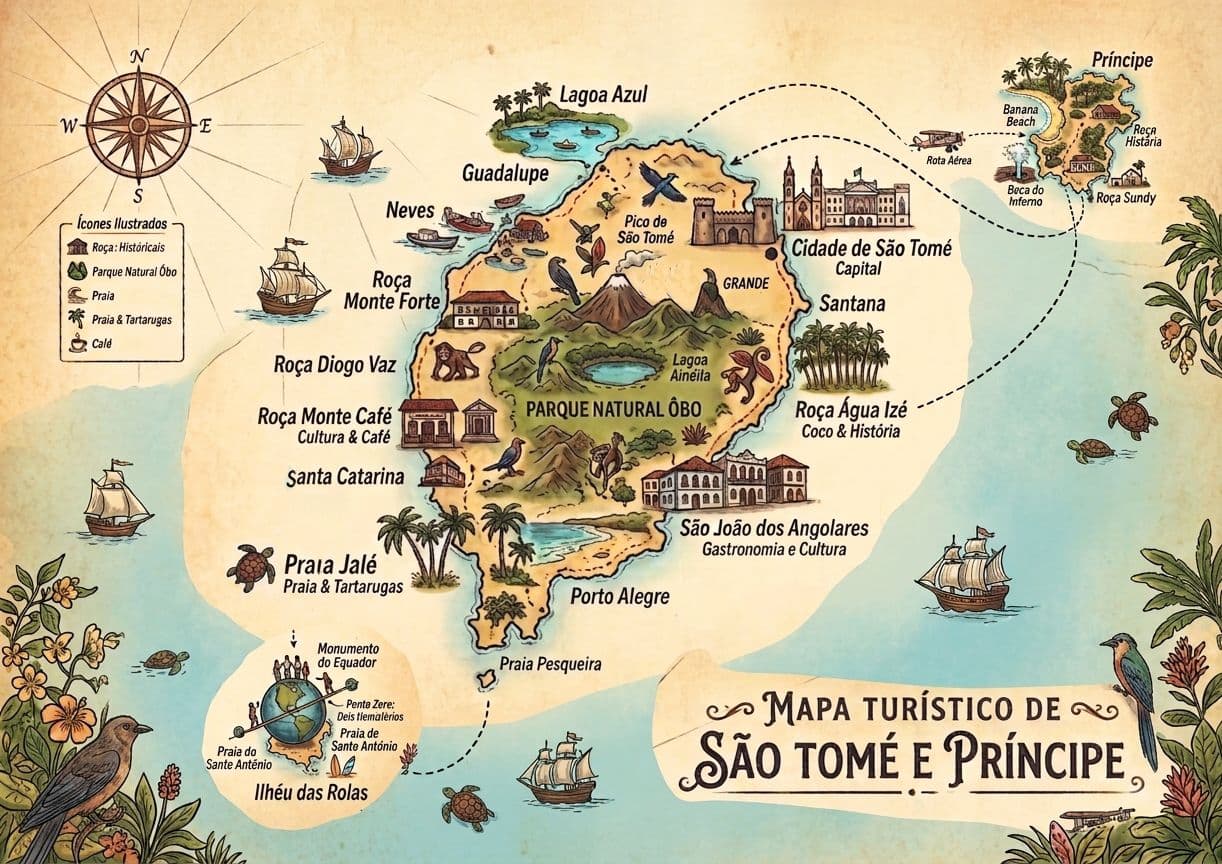
The island in six areas and three roads: a practical tourist map of São Tomé and Príncipe, with distances and days for each area.
This is the tourist map of São Tomé and Príncipe explained by people who drive its roads every day. Instead of a list of places, we show you how the island is organised: six areas, three roads that all leave from the capital, and the distance from each area to the city. With this you will know where to sleep, which areas to combine in one day and how many days to set aside for each. If you are looking for where the country is in Africa, read where is São Tomé and Príncipe first.
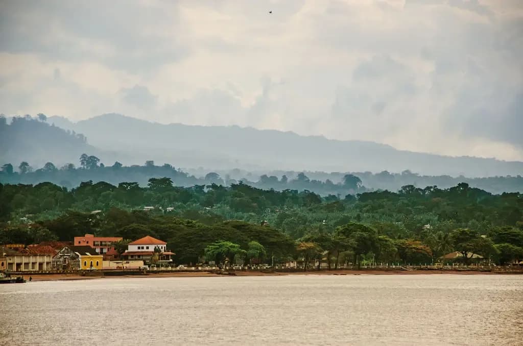
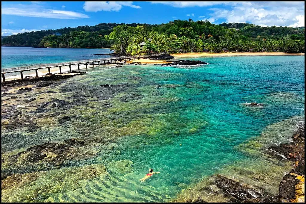
From sea to mountain in a few kilometres: that is the map of São Tomé. Photo: Príncipe Collection
How to read the tourist map of São Tomé
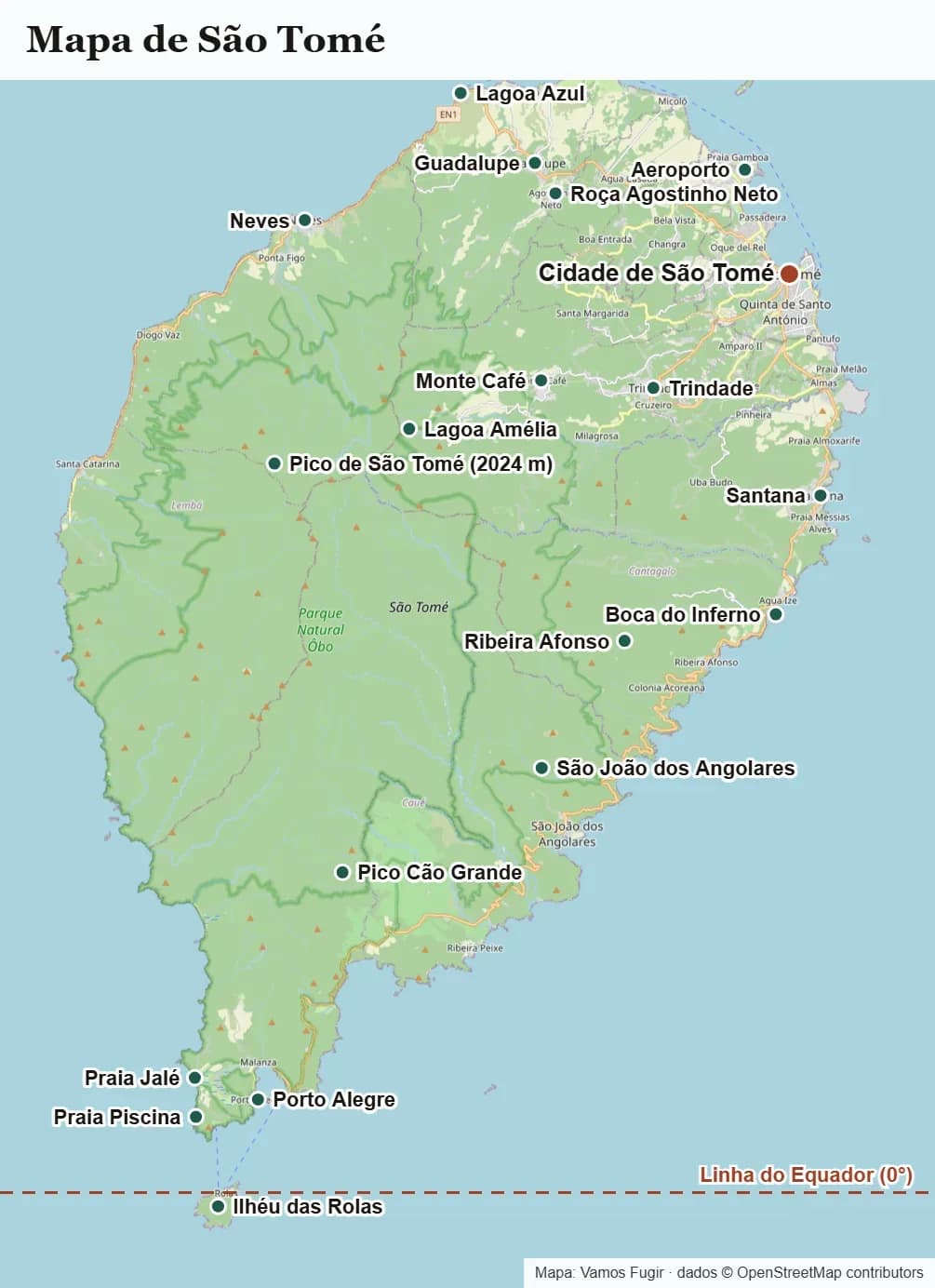
Tourist map of São Tomé island. Map: Jaca Voyage, data © OpenStreetMap contributors.
São Tomé island is small: about 48 km from north to south and 32 km from east to west, 854 km² in all. In the middle rises Pico de São Tomé, 2,024 metres high, surrounded by the forest of Obô Natural Park. That is why the roads don't cross the island in a straight line: they skirt the mountain along the coast.
To plan, you only need to remember three national roads, all of which start in the capital:
- EN1, to the north-west: from the city to Guadalupe and Neves, on the west coast.
- EN2, to the south: along the east coast to Santana, São João dos Angolares and Porto Alegre, at the southern tip.
- EN3, inland: from the city to the mountain plantations (roças), such as Monte Café.
In practice, every excursion is a return trip from the city along one of these roads. There is no road all the way round the island: the south-west is dense forest. So you can't do the north and the south in one loop; choose one direction per day.
The six areas at a glance
| Area | Road | Landmarks | Distance from the capital | Time to allow |
|---|---|---|---|---|
| 1. São Tomé city | — | Seafront, São Sebastião Fort, market | — | Half a day to a day |
| 2. North and west coast | EN1 | Lagoa Azul, Praia dos Tamarindos, Roça Agostinho Neto, Neves | About 30 min (Neves: about 1 hour) | One day |
| 3. Centre and mountains | EN3 | Monte Café, São Nicolau Waterfall, Bom Sucesso | About 30 min | One day |
| 4. East coast | EN2 | Santana, Água Izé, Boca do Inferno, Praia das Sete Ondas | Santana is about 9 km away | Half a day, or combine with the south |
| 5. South and Ilhéu das Rolas | EN2 | São João dos Angolares, Pico Cão Grande, Porto Alegre, Ilhéu das Rolas | São João dos Angolares about 24 km; Porto Alegre about 40 km | One to two days |
| 6. Príncipe Island | Flight of about 40 minutes | Santo António, Praia Banana, Bom Bom, Roça Sundy | A separate island | Three nights or more |
Distances are approximate, from town to town. Driving on the island is slow: bends, villages and often children and chickens by the roadside. Allow more time than the kilometres suggest.
Area 1: São Tomé city
The capital is in the north-east of the island, on a bay facing the sea. Everything is on foot or a few minutes by car: the seafront, São Sebastião Fort with the national museum, the Cathedral, the market and the colonial houses. The international airport is also on the edge of the city. It is the best base if you have only a few days, because all three roads start here. Everything about the capital is in our guide to São Tomé city.
Enjoying this article?
Get the day-by-day trip programme, with dates and prices
Sao Tome and Principe Tours: 8-Day Private Trip with a Local Guide8 days / 7 nightsfrom 1,250 €
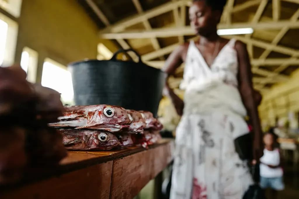
The capital's market, the starting point of any map of the island. Photo: Príncipe Collection
Area 2: the north and west coast (EN1 road)
Heading north-west out of the city, the landscape becomes drier and the baobabs appear. This is the area of calm, clear water:
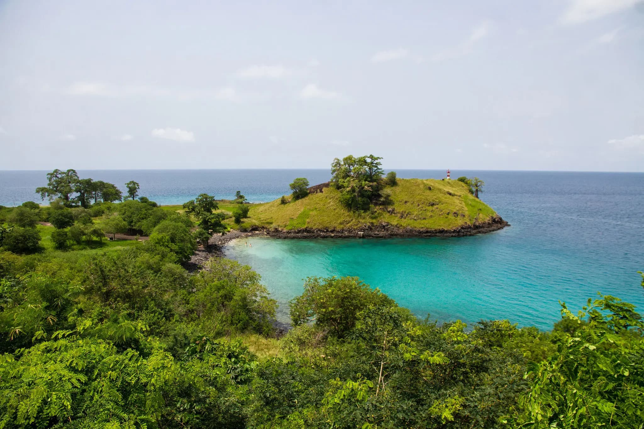
- Lagoa Azul: a turquoise bay, great for snorkelling. See how to get to Lagoa Azul.
- Praia dos Tamarindos and other quiet northern beaches.
- Roça Agostinho Neto, one of the largest cocoa plantations in the country. The Cocoa Route passes here.
- Guadalupe and Neves: the EN1 continues to Neves, capital of Lembá district, and from there south to Santa Catarina, about 13 km from Neves.
The north takes a day, with a fish lunch by the sea.
Area 3: the centre and the mountains (EN3 road)
On the EN3 you climb from the coast into the humid forest. The temperature soon drops and coffee plantations appear in the shade of the trees:
- Monte Café: the coffee plantation, with its museum and views over the island.
- São Nicolau Waterfall: a waterfall in the middle of the green, right by the road. Both are on the Coffee Route and São Nicolau Waterfall excursion.
- Bom Sucesso: the gateway to Obô Natural Park and the starting point for mountain trails, such as the one to Lagoa Amélia. See our hiking trails in São Tomé.
Bring a light jacket: it rains more and is cooler in the mountains than in the city.
Area 4: the east coast (EN2 road)
The EN2 leaves the city heading south, hugging the sea. Santana is about 9 km from the capital. Along this coast:
- Roça Água Izé: one of the great historic plantations, with its old hospital and workers' houses.
- Boca do Inferno: the sea surges into a volcanic rock tunnel and shoots out in jets of spray.
- Praia das Sete Ondas and other dark-sand beaches.
The east coast is rarely a day on its own: it is on the way south, so you do it on the way there or back.
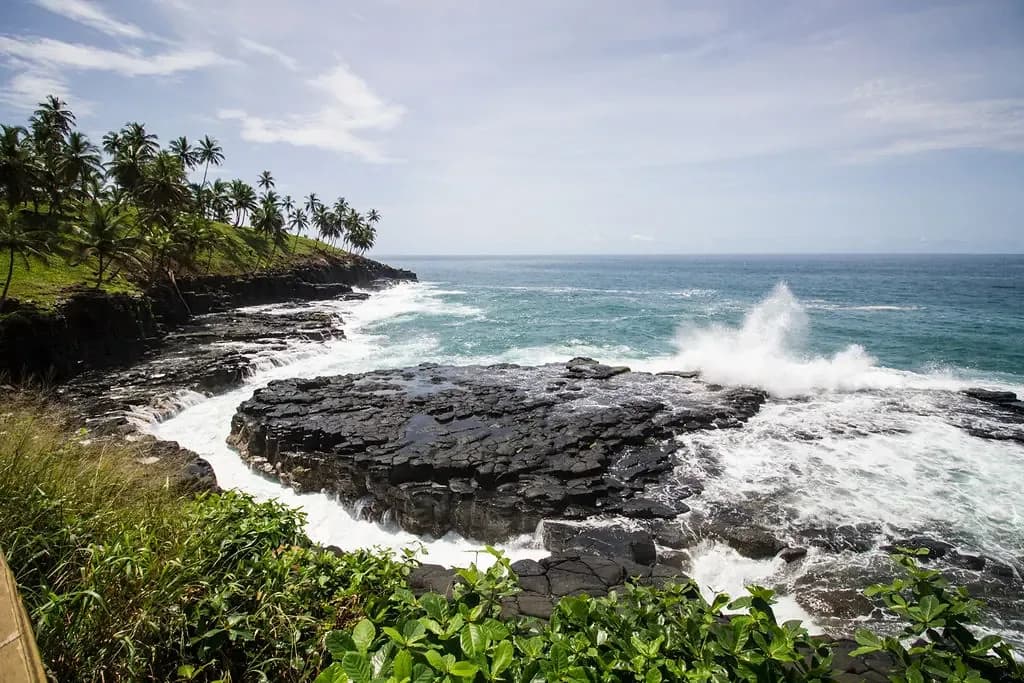
The east coast, on the way south. Photo: Príncipe Collection
Area 5: the south to Porto Alegre and Ilhéu das Rolas
This is the wildest area and the one that needs most time. The EN2 continues south:
- São João dos Angolares: the fishing village, about 24 km from the capital, with the roça and restaurant of chef João Carlos Silva. Learn the history of the Angolar people in the Angolares of São Tomé.
- Pico Cão Grande: the 663-metre rock needle you can see from the road. See our Pico Cão Grande guide and the viewpoints excursion.
- Porto Alegre: at the southern tip, about 40 km from the capital. The boat to Ilhéu das Rolas leaves from here, across the Rolas Channel.
- Ilhéu das Rolas: where the Equator passes, with its monument and pale-sand beaches. See Ilhéu das Rolas and the day excursion.
- Praia Jalé and Praia Piscina: beaches at the southern tip, between forest and sea.
To avoid spending the day on the road, it is worth sleeping one or two nights in the south.
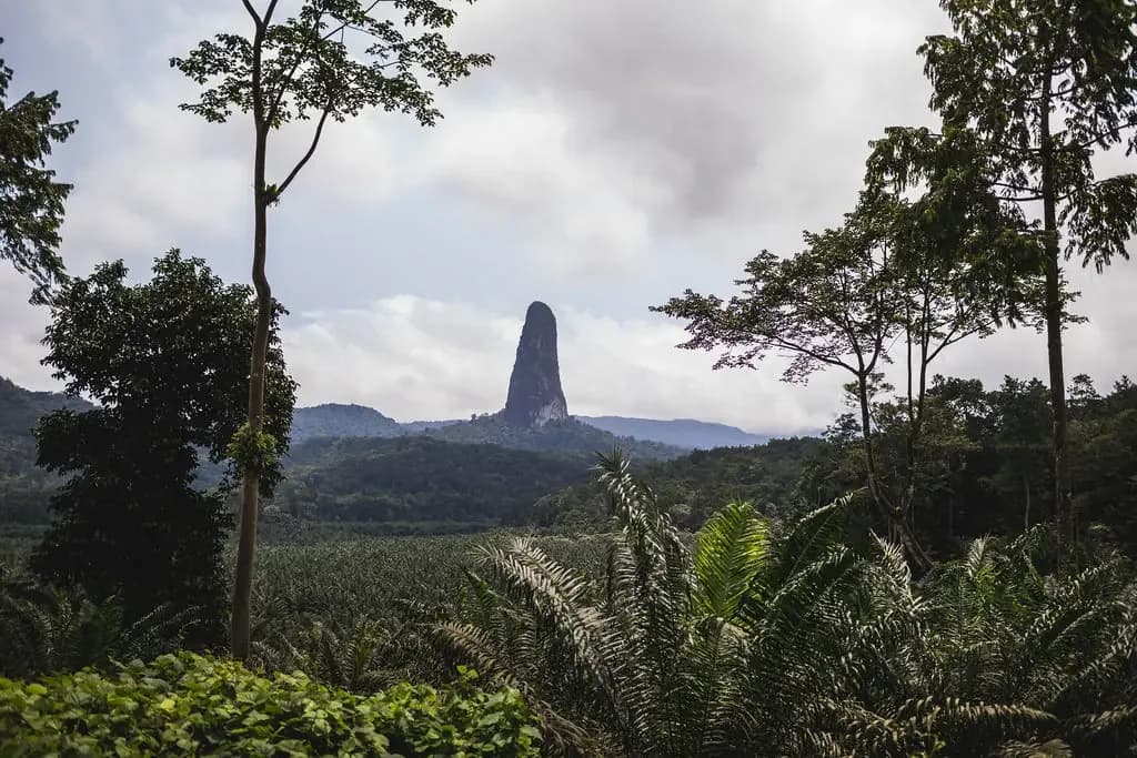
Pico Cão Grande marks the entrance to the south. Photo: Príncipe Collection
Area 6: the map of Príncipe Island
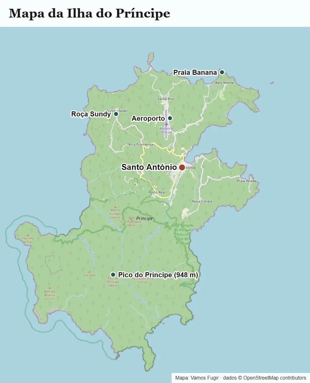
Map of Príncipe Island. Data © OpenStreetMap contributors.
Príncipe lies north-east of São Tomé, a flight of about 40 minutes away. It is much smaller and almost entirely covered in protected forest, a UNESCO Biosphere Reserve. On the map, think of three parts:
- Santo António: the tiny capital, near the airport, with colonial houses and a "leve-leve" pace.
- The north, with the hotels and beaches: Bom Bom, between the forest and two beaches; Roça Belo Monte, near Praia Banana; and Roça Sundy, where in 1919 the eclipse that confirmed Einstein's theory was photographed (under renovation).
- The wild south: rock peaks, bays and beaches seen mainly by boat.
Excursions on the island are organised by the hotels themselves. The flight, the 15 kg baggage limit and how many nights to stay are in how to get from São Tomé to Príncipe.
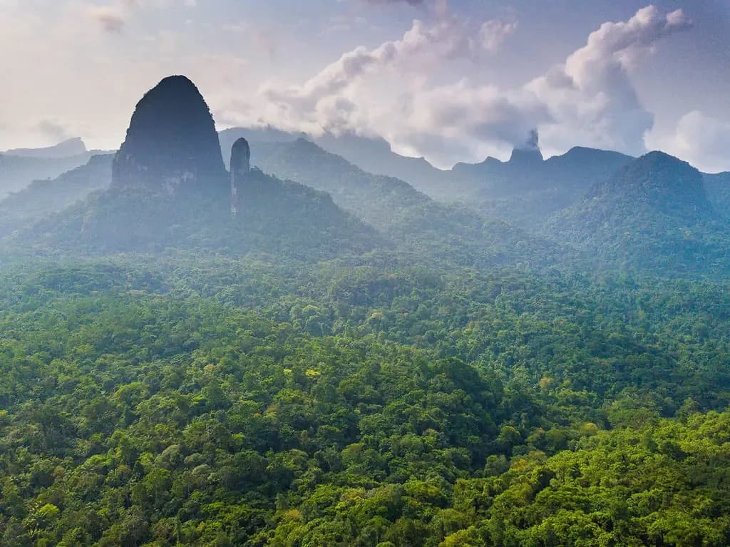
Príncipe Island seen from the plane. Photo: Príncipe Collection
Which area suits which traveller
| If you like… | Go to… |
|---|---|
| Beaches and calm water for snorkelling | The north (Lagoa Azul) and Ilhéu das Rolas |
| Hiking and forest | The centre and mountains (Bom Sucesso, Obô) |
| The history of cocoa and coffee | The plantations of the north, centre and east coast |
| Dramatic landscapes and local life | The south (São João dos Angolares, Cão Grande) |
| A honeymoon and near-deserted beaches | Príncipe Island |
| A short break | The city, north and centre, based in the capital |
How many days to allow for each area
- City: half a day, on arrival or on the last day.
- North: one day.
- Centre and mountains: one day; one more if you want to hike to Lagoa Amélia.
- East coast and south: one to two days, ideally sleeping in the south.
- Ilhéu das Rolas: one day, from Porto Alegre.
- Príncipe: at least three nights.
All in, a week is enough for São Tomé island; with Príncipe, allow 10 to 12 days. See how many days to spend in São Tomé and Príncipe, where to sleep in each area in our São Tomé and Príncipe accommodation guide, and the full list of places in what to see in São Tomé and Príncipe. If you would rather we handle the route, the 8-day tour covers every area of São Tomé island, with an English, French or Spanish-speaking guide.
Frequently asked questions
Is there a tourist map of São Tomé and Príncipe to use on the trip?
The most practical way is to think in six areas: the city, the north, the centre, the east coast, the south and Príncipe Island. The three national roads (EN1, EN2 and EN3) all start in the capital, so each area is a return trip from the city.
How big is São Tomé island?
About 48 km from north to south and 32 km from east to west, 854 km² in all. The highest point is Pico de São Tomé, at 2,024 metres.
Can you drive all the way round São Tomé island?
Not completely. The roads follow the coast from the capital, north and south, but the south-west is forest. So you visit the north one day and the south another.
How far is the south from the capital?
São João dos Angolares is about 24 km away and Porto Alegre, at the southern tip, about 40 km. The road has many bends and villages, so it takes longer than the kilometres suggest.
Where is Ilhéu das Rolas on the map?
At the southern tip of São Tomé island, opposite Porto Alegre, across the Rolas Channel. You get there by boat.
What is the best base for exploring São Tomé?
For a few days, São Tomé city, because all three roads start there. For a week, add one or two nights in the south.